
POTA / SOTA
Table of Contents
POTA (Parks on the Air) and SOTA (Summits on the Air) are just two programs encouraging portable operations in either US National/State Parks/Historic trails, or on Summits.
The PAARA Discord server (read PAARAgraphs to find the invite link) has a bot that will post a message whenever a PAARA member call sign is activating a park or a summit, so that other members can try to hunt or chase from their location.
If you’d like to know more, or you’d like to join one of us for an activation in a nearby park, please get in touch with us on Discord on #pota or #sota, or reach out to Connie (W6EFI), Elliot (AK6EU), Justin (AI6YM), or Sorin (KN6YUH).
We are very fortunate to have not one but two National Historic Trails running right through Palo Alto. That means public spaces next to El Camino as well as many city parks are good locations for POTA activations. (US-4571 and US-9757, see below for details.) The POTA map site does not show full trail locations but they are located on the National Park Service’s maps. See below for links.
Parks on the Air (POTA)
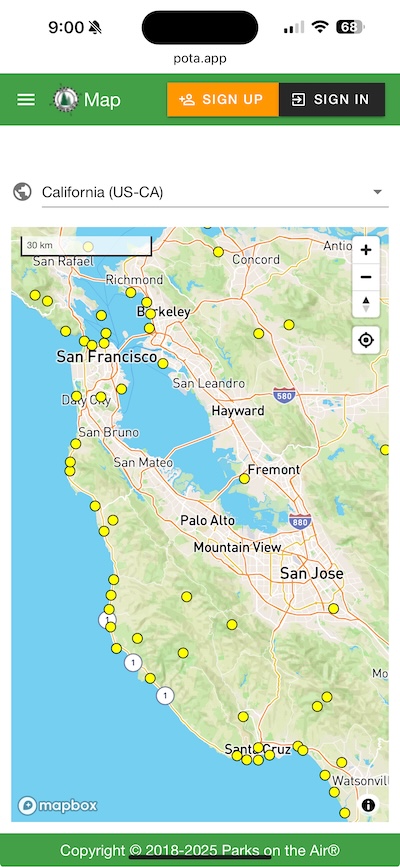
Website: pota.app
Parks on the Air (POTA) is an international ham radio program that encourages licensed amateur radio operators to set up portable stations in national, state, and local parks to make radio contacts, promoting outdoor activity and radiosport. Participants, known as “activators,” operate from within the park and aim to make as many contacts as possible, while “hunters” try to contact activators from any location. The program offers awards for achievements such as the number of parks activated or contacted, and supports a variety of operating modes including voice, Morse code, and digital modes, all while respecting park regulations and other visitors.
You need to make 10 contacts for a successful activation, and the activator is the only one who needs to upload the logs at the end. It’s good practice to upload the logs even for an unsuccessful activation, because this way you reward the hunters.
Nearby Parks
A few nearby parks popular with club members for POTA:
| ID | Park Name | Comments |
|---|---|---|
| US-1161 | Henry W. Coe State Park | Nice views, short hike from the parking lot |
| US-1136 | Castle Rock State Park | Features waterfalls and rock climbing, has EV charging |
| US-1187 | Portola Redwoods State Park | You need to hike up to higher ground from the Visitor Center |
| US-0189 | Don Edwards San Francisco Bay National Wildlife Refuge | Multiple locations around the south tip of the Bay are within park limits |
| US-3473 | Martial Cottle Park State Recreation Area | Accessible, but many people have complained about QRM, not recommended |
| State Beaches along Highway 1 | 30+ entities between SF and Monterey offer multi-park roving routes |
Nearby Historic Trails
There are two historic trails crossing the Bay Area. You can activate from any publicly accessible space within 100 feet of the trail route:
- US-4571 Juan Bautista de Anza National Historic Trail: https://www.nps.gov/juba/planyourvisit/maps.htm
- US-9757 Butterfield Overland National Historic Trail: https://www.nps.gov/buov/planyourvisit/maps.htm
NOTE: If you activate from a location where these two historic trails overlap, you’ll be able to score a “2-fer”! In Parks on the Air (POTA), a “2-fer” refers to an activator operating from a location that is within the boundary of two POTA parks. This means you’re essentially activating both parks simultaneously during one QSO (radio contact).
local POTA map from the official site
Summits on the Air (SOTA)
Summits on the Air (SOTA) is a similar ham radio activity focused on operating from mountain or hill summits. Operators, called “activators,” hike to designated summits carrying lightweight radio gear and attempt to make contacts with other hams, known as “chasers,” who try to reach them from anywhere. Each summit has an assigned point value based on its elevation, and both activators and chasers earn points toward awards. SOTA emphasizes portable, battery-powered operation and often requires making at least four unique contacts from within 25 meters of the summit, blending amateur radio with hiking and outdoor adventure.
Nearby Peaks
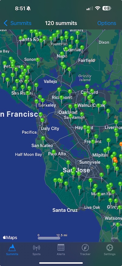
A full list of all qualifying summits worldwide can be found on the SOTA website at
There are 538 qualifying summits in the Northern Coastal Ranges and 74 qualifying summits in the Coastal Ranges
A few of the higher peaks and somewhat accessible in the Bay Area below:
| ID | Summit Name | Comments |
|---|---|---|
| W6/NC-049 | Black Mountain | 1204m, 2 points |
| W6/CC-045 | Mount Diablo | 1173m, 2 points |
| W6/CC-052 | Mount Umunhum | 1063m, 2 points |
A few of the taller mountains nearby that would work pretty well for UHF/VHF contacts given the proximity to the highly populated Bay Area.
Useful Apps
- Logging: HAMRS
- SOTA: SOTA Goat for iOS
- POTA Maps (with SOTA Peaks): https://potamap.us